Home Devon County Harberton Parish Harberton Village Tristford Cholwell
Please use the Contact us facility for any comments.
If you share my fascination for old maps, particularly of our local area, please read on.
Want to look at maps of the local area going back to first series O.S. 1880,
the Tithe Map of the 1840s, and more?
Then see here:
https://maps.bristol.gov.uk/kyp/?edition=devon.
You can, for example, compare different maps side by side.
The Tithe Map for Harberton parish and the associated tithe apportionments
can be viewed here:
https://www.devon.gov.uk/historicenvironment/tithe-map/harberton.
Be advised that this is a very large detailed image and takes a little while to
get used to navigating (zooming etc.).
Old Maps - https://maps.nls.uk/geo/explore/#zoom=17.0&lat=50.41477&lon=-3.72363&layers=178&b=1 Fascinating old mapping from the National Library of Scotland, with O.S. maps going back to 1873. This particular link takes to to the centre of Harberton in 1873 or thereabouts.
Comparison of maps from different periods can reveal many points of interest such as changes in residential areas, differences in spellings of place names, even changes in road patterns from the earlier maps. In all cases below, you can click a thumbnail to open an enlarged view in a separate new window.
|
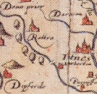
Harberton shown on the 1575 Saxton map of Devon |
The earliest printed map of the County of Devon was published by Saxton in 1575 as part of his Atlas of England and Wales in 1575. In total, 117 different maps of the county were published between 1575 and 1837. A further 65 different maps appeared during the Victorian period 1838-1901. The statute mile (1760 yards) was not finalised until 1685. No roads were clearly shown on any maps of Devon up to 1695.
Until the Ordnance Survey (formally founded in 1791), only Saxton and Donn (publ. 1765) produced surveys of any importance of the whole county. Most of the other maps are copies of one form or another. In 1809, Devon was the second Ordnance Survey county map to be published.
For anyone interested in the history of mapping, and the mapping of Devon in particular, two wonderful reference books (both available from Devon County Library) written by Kit Batten and Francis Bennett are a must: "The Printed Maps of Devon, County Maps 1575-1837" (ISBN 0861149009), publ. 1996, and "The Victorian Maps of Devon, County Maps 1838-1901" (ISBN 1855227568), publ. 2000, both by Devon Books. These contain illustrations of every single county map published.
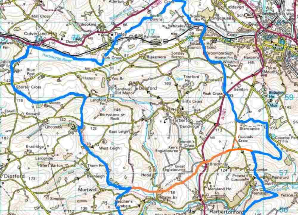
The following three maps cover the same area - the Harberton side of the parish = Harberton electoral roll area (above the orange line and inside the blue line in the right-hand image below which essentially defines the area of coverage of this website and of the Harberton Email Circulation).
Click a thumbnail for an enlarged view in a separate window.
 |
 |
 |
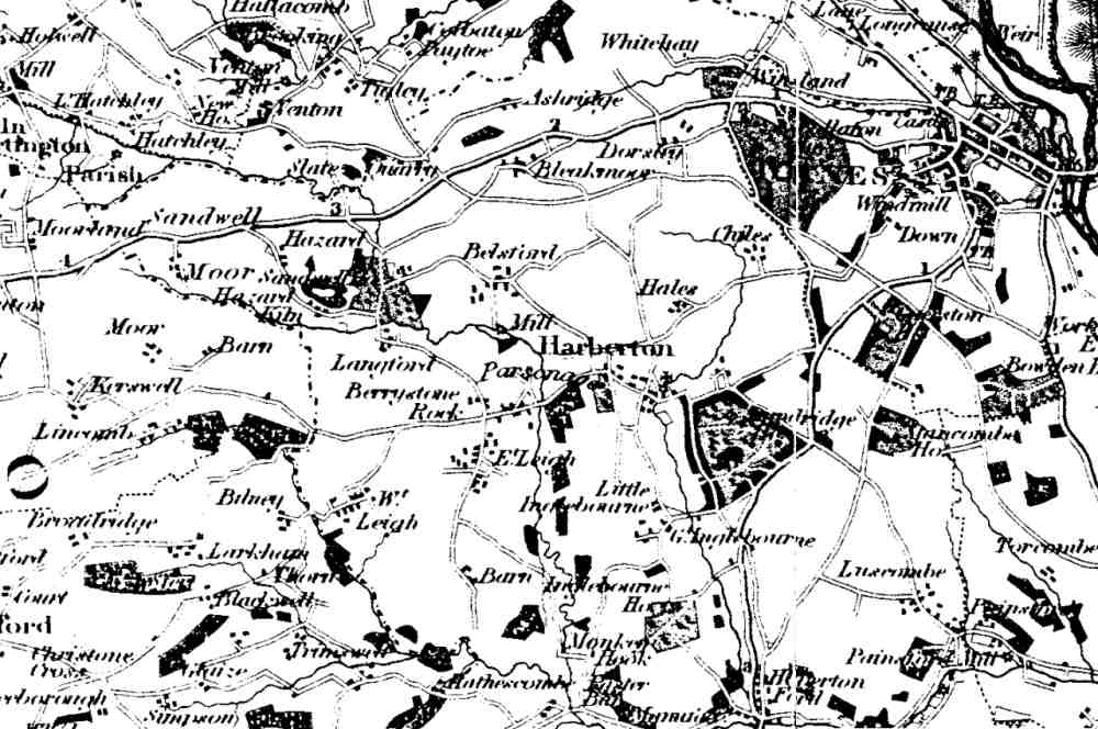
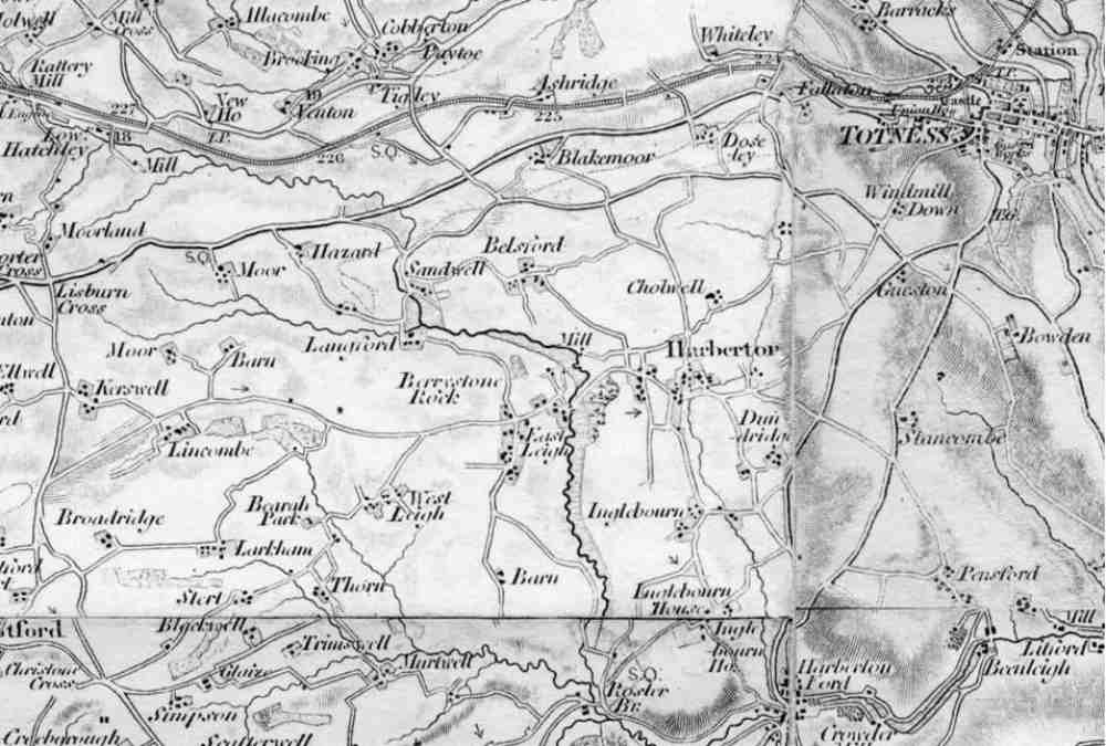
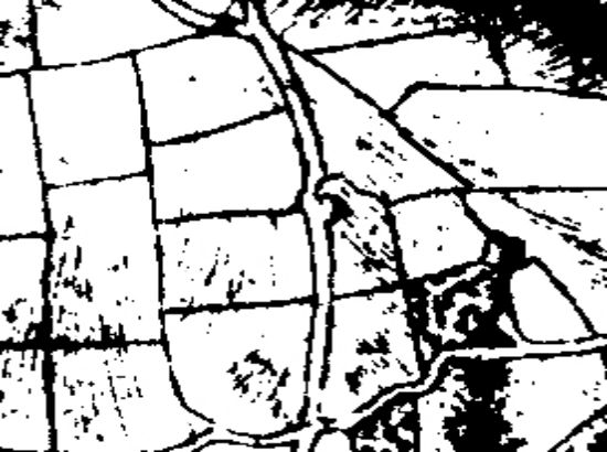
| 1825 Greenwood | ca. 1883 ?? | Current OS, with Harberton boundary indicated |
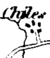
Look carefully at the area immediately north of Harberton, where Tristford and Cholwell are today. Tristford was built around 1849 near the site of a mediaeval farm called Hele Pane Barton, presumably the 'Hales' in the 1825 map, while 'Chiles' must be (Higher) Cholwell. The 1883 map does not yet show the new Tristford, but the corresponding area is incorrectly labelled 'Cholwell', while the actual Cholwell area further north-west is unlabelled.
The following four maps cover Harberton village up to Gills Cross.
Click a thumbnail for an enlarged view in a separate window.
 |
 |
 |
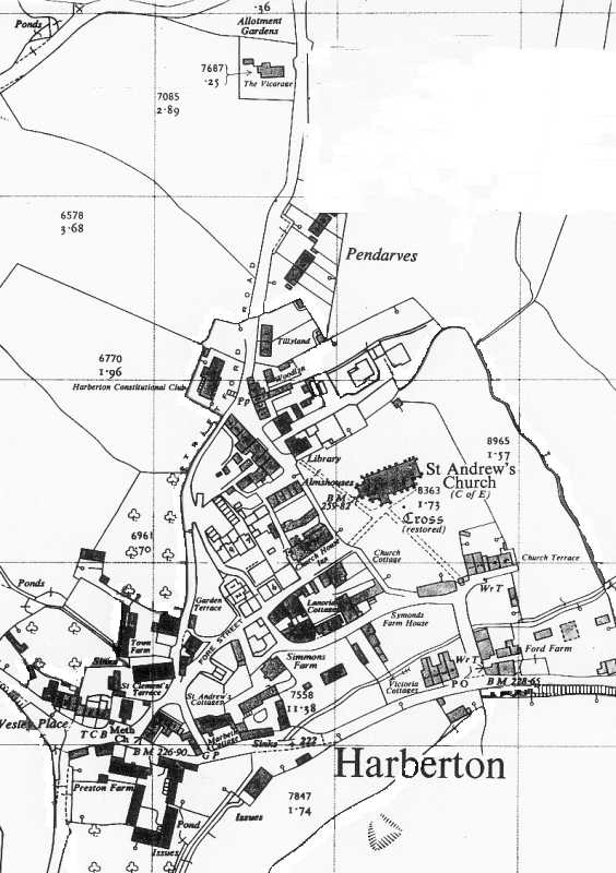 |
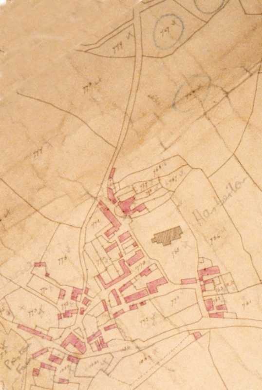
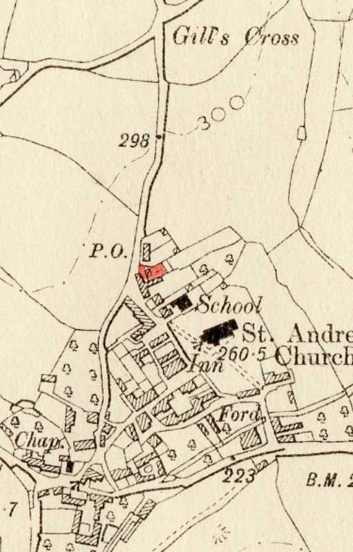
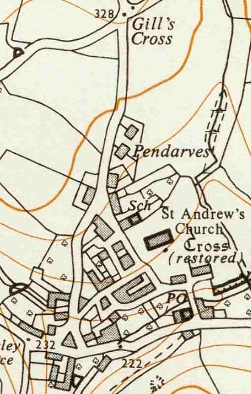
| 1842 | 1904 | 1963 | 1995 |
Amongst other things, the tithe map from 1842 shows "Fleas
Alley" where St Clement's Terrace now stands, other buildings pre-dating
Lanoria Cottages, a single block of buildings comprising the old Garden Terrace
and Fore Street (where Church Court now stand) and other buildings beside the
Church House Inn.
The 1904 map shows various changes, including the presence of the Post
Office at Tillyland.
1963 shows the Post Office relocated to Post Office Corner at the bottom
of the village (this change probably occurred early in the century), and the
addition of Pendarves.
Finally, the map published in 1995 (but showing a status from the early
1970s) illustrates the disappearance of the school, but still shows the
almshouses and Church Terrace. It also has a minor error, retaining the name
Garden Terrace even though the new Church Court complex has already been built
on the site adjoining Fore Street. The Post Office remains in the 1963 position.
Click a thumbnail for an enlarged view in a separate window.
 |
 |
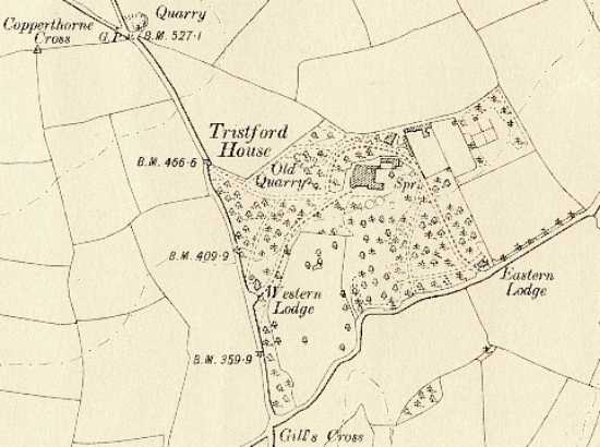 |
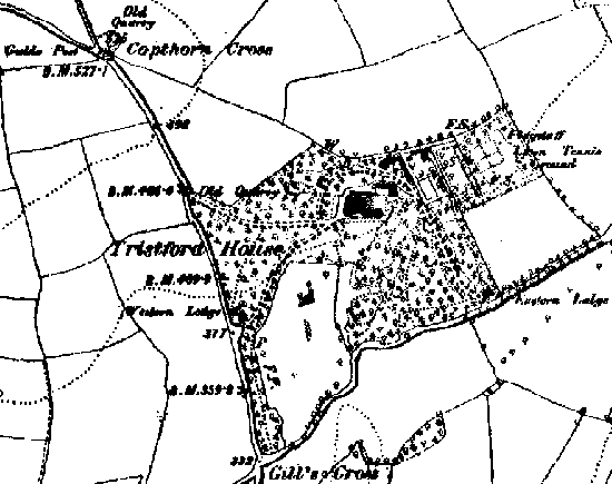
| ca. 1804 | ca. 1889 | ca. 1906 |
1804 shows the Tristford area well before the estate was set up in
Victorian times (Tristford House built in 1849), with mostly open fields except
for the second field to the right, north-west of Gills Cross, where Hele Pane
Barton farm stood.
Great changes by 1889 with large areas of woodland and
a system of driveways. The woodland, long since gone, north of the driveway
between Tristford House and its Western Lodge can be clearly seen in an old postcard.
This map also details a Flagstaff and Lawn Tennis Ground.
At this time the main driveway swept round to the north of the house and the
present-day drive at the back of the house was then just a service access. Clearly visible on the 1906
map are also the two walled gardens, with the heated greenhouses
along the north wall of the first.
Click a thumbnail for an enlarged view in a separate window.
 |
 |
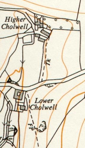 |
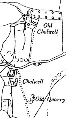
| ca. 1825 | ca. 1885/1904 | ca. 1963 |
The originally inhabited area of today's Cholwell appears as "Chiles" on an 1825 map. The 1904 map then refers to this as "Old Cholwell" following building of a new farm in 1885 (dated on a roof truss) named here as "Cholwell". As shown in the 1963 map, the latter is now known as "Lower Cholwell", while the original settlement is now "Higher Cholwell".
Some map images on this website are produced from the Ordnance Survey Get-a-map
service and are reproduced with kind permission of Ordnance Survey and Ordnance Survey of Northern Ireland.
Other images may be copyrighted and will be removed from this website
immediately upon request from the copyright holder.