
Click thumbnail below for an enlarged view in a new window. File sizes are typically between 50 and 100KB.
A sequence of pictures taken between 09.38 and 10.51 on Sunday 6th November 2005. On a larger and more violent scale, the process illustrated below has been a major factor in causing serious flooding in Harberton on various occasions in the past. This relates specifically to water entering from the western end of the village.
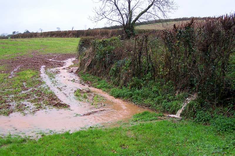
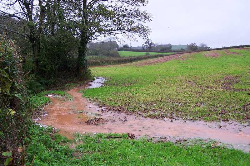
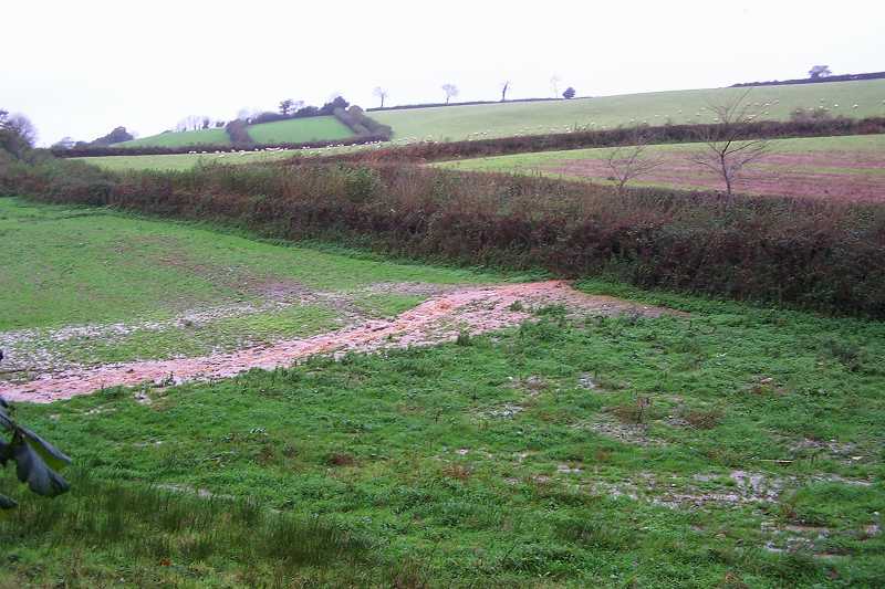
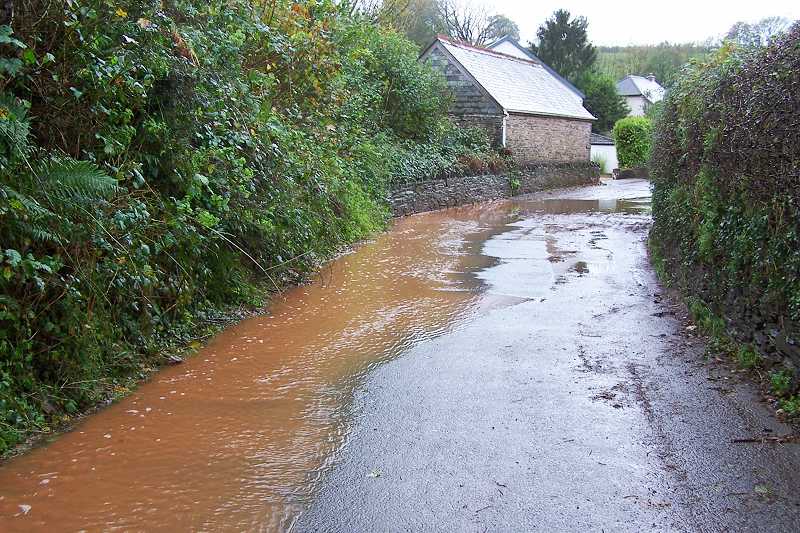
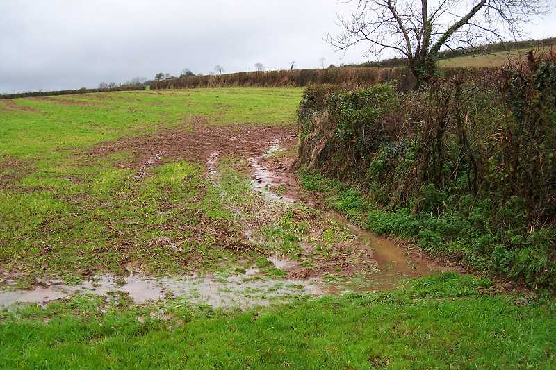
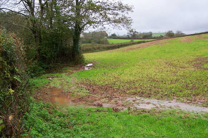
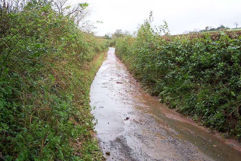
The first image, actually taken later at 12.43 (after the event), still shows water flowing in channels from one of the main source areas above the village. Visible surface water in this field is a sure sign of trouble further down. The next two above timed at 09.38 show the water about to reach Screw Lane.
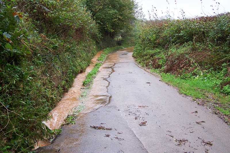
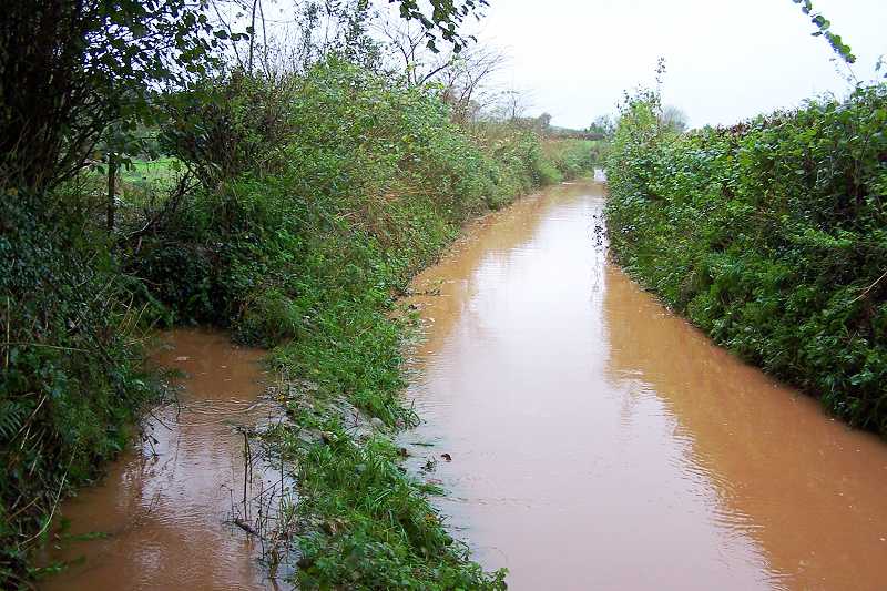
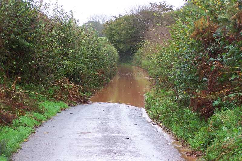
A new 10-inch pipe was installed under Screw Lane last year following the collapse of the old smaller iron pipe. Partly blocked buddleholes cause a build-up of water deeper than tall welly boot height along Screw Lane (this buffers some of the main flood flow for a while) as the water cascades into Tristford Farm Orchard, where the new pond also buffers some of the flood flow for a while).
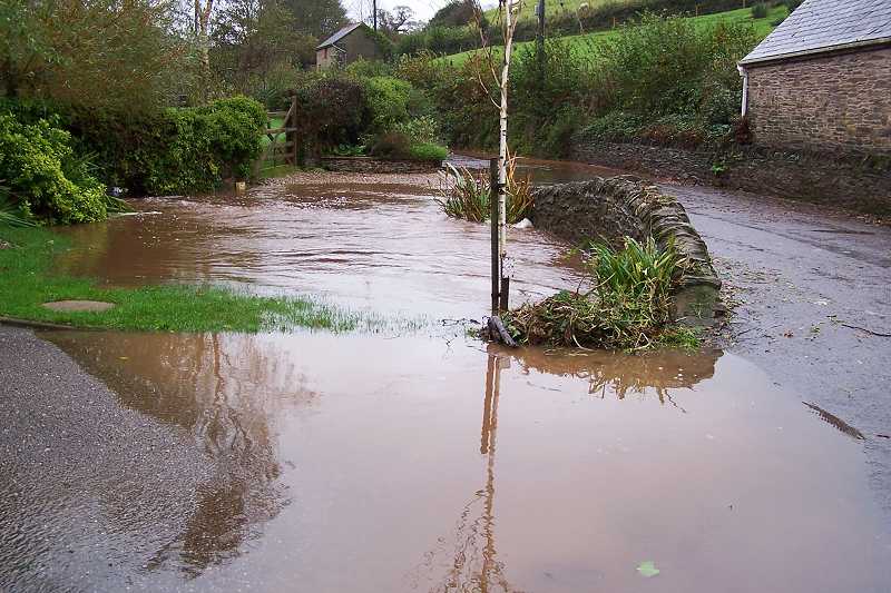

Meanwhile down by the ford there's plenty of water coming in from the other
end of the village but no flooding on this day. The first of the above four
images shows a pile of debris cleared from the screen by a local resident.
We've since been told by that resident that earlier in
the day the road had in fact been badly flooded to a significant depth around
the bridge area due to "water flowing down the minor roads from the main
Totnes to Kingsbridge highway".
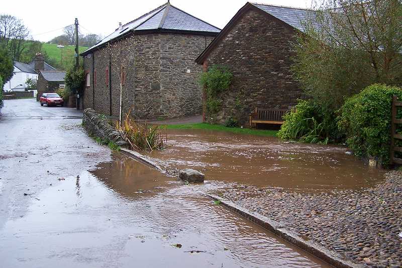
The
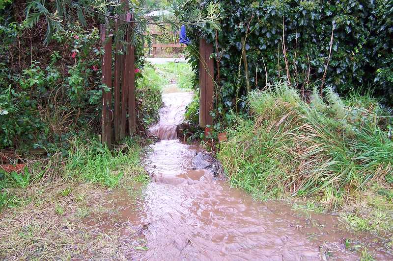
second shows water actually flowing out of the stream and across the road into
a gully. The third shows the usual roadside flow due to blocked drains. But
behind St Clements Terrace there's a problem...
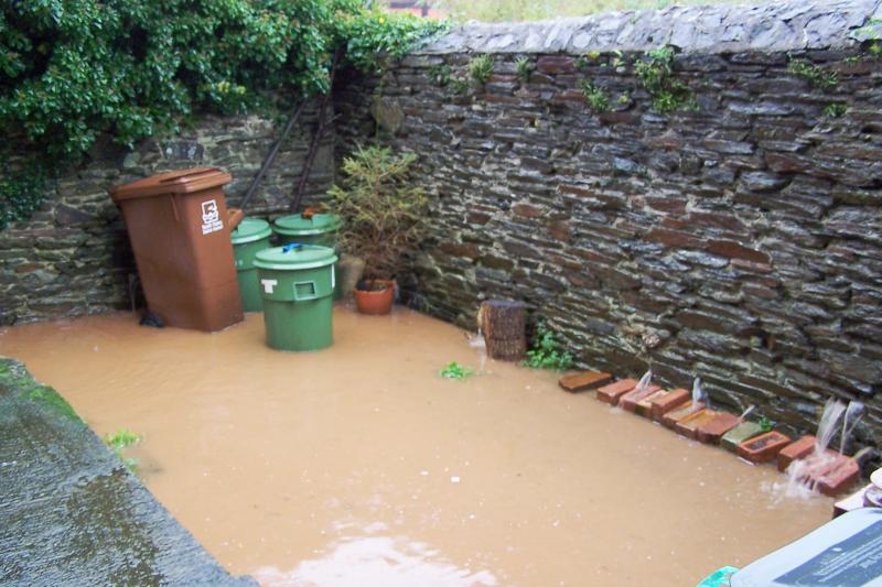
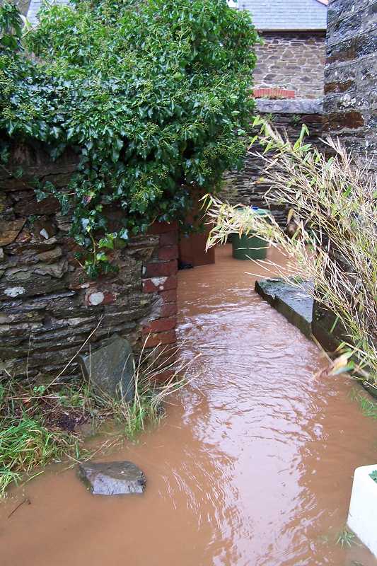
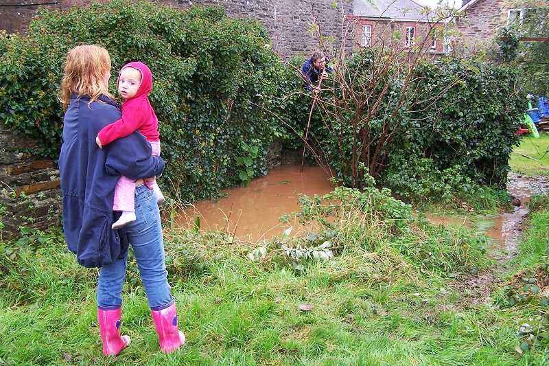
The time is now 10.18. The screen is partially blocked, water is running through the garden gateway, through the wall behind Nos. 1 and 2, and the water is rising towards their back doors. But help arrives in the form of another local resident with a long pole and a ladder. From behind the wall he manages to clear the screen sufficiently to allow this flood danger to clear. The time is 10.27.
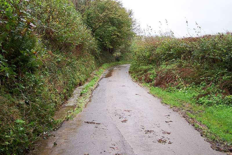
Meanwhile, back at our second picture location above, at 10.49, the flood flow from the fields has largely ceased and the impassable flood, probably 50 yards long, has disappeared from Screw Lane.