 Harberton, Devon
(England) lies at coordinates 50.4130°N, 3.7240°W.
Harberton, Devon
(England) lies at coordinates 50.4130°N, 3.7240°W.Harberton, Devon
(England) lies at coordinates 50.4130°N, 3.7240°W.
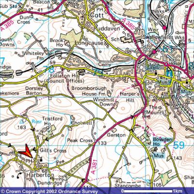
Once in South Devon:
Harberton is about 3 miles
south-west of Totnes (top right of this map) and is most easily reached by taking the third right
(second right is No Entry) off the main A381 Totnes to
Kingsbridge road after leaving Totnes.
The red arrow on the map marks the location
of Harberton Parish Hall.
Image produced from the Ordnance Survey Get-a-map service. Image reproduced with kind permission of Ordnance Survey and Ordnance Survey of Northern Ireland.
Check out www.streetmap.co.uk for a detailed map of the village, where the yellow arrow points to the Parish Hall. There is a zoom facility alongside the displayed map to show the village in wider contexts.